

São Miguel Island , nicknamed "The Green Island", is the largest and most populous island in Portuguese Azores archipelago. The island covers 759 km2 (293 sq mi) and has around 140,000 inhabitants, 45,000 of these people located in the largest city in the archipelago: Ponta Delgada.
São Miguel is bisected by many faults from the northwest to southeast in the direction of the Terceira Rift, a triple junction of the Eurasian, African and North American tectonic plates. This system is best expressed in the western part of the island with extensive geological formations, such as the Mosteiros Graben(along the western flank of the Sete Cidades Massif), the Ribeira Grande Graben (along the northern flank of the Água de Pau Massif), and the many cones and fissural structures along the interior of the island. In the ancient crater of Furnas the faults are aligned west-northwest to east-southeast. Zbysewsky (1959), among others (note references) identifies eight geomorphological structures on São Miguel that correspond to the formative features that built the island, including:
- The Sete Cidades Massif - an area that occupies the extreme western part of the island, and corresponds to a central volcanic crater and lake-filled caldera, with various cones, deposits of pumice, lava domes and maars. In the northeastern flank of this volcano the Mosteiros Graben, a tectonic structure created from the collapse of lands and located along a northwest to southeast orientation. Along other regional fractures and radial faults there are ancient spatter cones and lava domes;
- The Picos Region - is situated along a northwest-southeast alignment, and defines a range of spatter cones and relatively level ground between the Sete Cidades and the Água de Pau Massifs;
- The Água de Pau Massif - this central feature corresponds to the central volcano on the island, and includes the Lagoa do Fogo (Lake of Fire), many lava domes and pumice cones. On the northeastern flank of the Massif the Ribeira GrandeGraben is visible, representing a tectonic depression oriented northwest to southeast;
- The Achada das Furnas Plateau - a region with a central plain marked by cones and maars, with deposits along a west-northwest to east-southeast and northwest to southeast;
- Furnas Volcano - located in the eastern part of the island, along the southern coast, and comprising two ancient calderas, occupied by a lake (Lagoa das Furnas). Within the system one can find many pumice cones, maars and lava domes;
- Povoação Volcano - comprising a central caldera, generally well-eroded and whose southern rim has disappeared to the southern coast. Within its interior, marked by several river-valleys and cliffs, are several spatter cones;
- The Tronqueira Region - it occupies the extreme easterly portion of the island and corresponds to a mountainous region, divided by many river-valleys that are usually delineated by tectonic fractures;
- The Northern Coastal Platform - located along the northeastern portion of the island, and marks a zone of relatively moderate topography, limited by the coast to the north and the northern crater rims of Furnas and Povoação volcanoes to the south.
These geomorphological structures have resulted from millions of years of compound growth that began in the eastern portion of the island; around 4 Million years ago the Nordeste Volcano burst from the ocean floor in effusive and fissural eruptions. These eruptions were composed of basaltic lava flows and spatter cones who's products reached a height of 1,100 metres forming the mountainous region of Tronqueiro, Planalto dos Graminhais, Espigão dos Bois and Pico Verde (finding its maximum extent in Pico da Vara). But, about 950,000 years a secondary volcano system (Volcanic Complex of Povoação) supplanted the eruptions of the Nordeste Volcano, responsible for new basaltic lavas and pyroclastic deposits. With an age of 200,000 years the third volcano on São Miguel, the Água de Pau Volcano started erupting on the western flank of Povoação volcano in two phases. The first phase, composed of the older materials, erupted from lava flows and Trachyte pyroclasts, the secondary phase corresponded to volcanic products that began erupting 400,000 years ago. These latter deposits included pyroclastic, trachyte flows (lava and surges), mud flows and a mixture of basalts. In what would become the western portion of the island a fourth volcano formed: the Sete Cidades Volcano erupted 200,000 years ago and continued to erupt until about 36,000 years ago. Between 100,000 and 3,800 ago fissural eruptions of integrated lava and basaltic pyroclastic deposits occurred in the center of the island between Água de Pau and Povoaçãp, forming the Fissural Volcanic System of Congro. These eruptions were explosive and fed by activities in the neighboring volcanic systems. At about 100,000 years a secondary system developed along the frontier of the Povoação volcano, the "Furnas Volcano" complex (the youngest volcanic system) in three phases mixing pyroclastic surges, trachytes, and lava flows, as well as explosive materials. Finally, two layers of deposits formed the Fissural Volcanic System of Picos between the volcanic Água de Pau and Sete Cidades from 31,000 years ago unifying the island. This formation integrated lavas, basaltic pyroclasts, tuff cones and trachyte domes into two layers (referred to as the Ponta Delgada and Penhal da Paz sub-depoists) and compiled to about 5000 years ago.

The ancient laurisilva forest has mostly been replaced by cultivated fields and imported trees and plants, such as the ubiquitous cryptomeria trees. There are some hot springs (caldeiras), generally located in the center of the island, in the area stretching from Povoação to Nordeste.
The peak area between Sete Cidades and Fogo is a monogenetic volcanic field composed of 270 volcanoes. They are primarily made up of basaltic cones which were formed during Strombolian and Hawaiian-style eruptions. This is the part of the island with most recent volcanic activity. The youngest volcanoes are relatively well dated. It is estimated that 19 eruptions have occurred during the last 3,000 years. Several eruptions have been witnessed and recorded by people. The last one took place in the 17th century. The most famous eruption is known as Fogo 2, occurring in 1652.
The highest elevation on São Miguel is the Pico da Vara at 1,103 m. Lying at the eastern end of the island, it is the focus of aSpecial Protection Area containing the largest remnant of laurisilva forest on the island, which is home to the endemic andcritically endangered bird, the Azores Bullfinch.

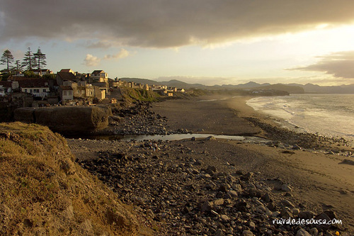
Owing to the predominance of volcanic cones and craters in the interior, human settlement has developed primarily along coastal and interior plains. In addition, there are several communities that have developed within ancient craters (such as Sete Cidades, Furnas or Povoação, river-valleys (such as Ribeira Chã, Pilar da Bretanha) or coastal deltas (Mosteiros). Regardless, these settlements were largely agrarian and concentrated around the parish churches and the many fertile parcels of land. The communities were largely isolated throughout the year, owing to the greater distances and rough landscape of the island, and only became integrated with the development of the many road networks that circle and bisect the island. Two cities have developed, largely because the island was divided by mountainous volcanic cones in the interior: Ponta Delgada and Ribeira Grande. Administratively, the island is governed by five municipalities, with Ponta Delgada and Ribeira Grande having more administrative functions associated with their larger populations:- Lagoa - the youngest of the municipalities of São Miguel, with a population of 14 126 inhabitants, and incorporating the south-central parishes east of Ponta Delgada;
- Nordeste - literally the north-eastern municipality, well known for an abundance of natural vegatation and the highest point on the island, Pico da Vara;
- Ponta Delgada - the municipality although including the hihgly industrial city of Ponta Delgada, also includes many rural parishes, as well as the large crater of Sete Cidades;
- Povoação - home to the first colony on the island, Povoação is located in the south-east corner and includes active and dormant volcanic features, includingFurnas and the crater of Povoação;
- Ribeira Grande, São Miguel - second largest municipality, with 30,852 inhabitants (its city received its charter in 1981) and incorporates an extensive area of the northern coast; and
- Vila Franca do Campo - located along the southern coast between Lagoa and Povoação, Vila Franca was the location of the historical capital of São Miguel, until it was almost destroyed by earthquake and landslides in 1522.
